A New Tool to Help Plan for and Protect Against Floods
By Crystal Bergemann, Senior Director for Resilience, Council on Environmental Quality & Kris Ludwig, Assistant Director for Resilience Science & Technology, Office of Science & Technology Policy
Flooding is the most common and costly natural hazard in the United States. This spring season alone, approximately 122 million people are projected to be at risk for flooding. A changing climate means that communities will increasingly face floods that damage homes, businesses, and infrastructure; imperil public health and safety; and interrupt economic prosperity and national security. From 1980-2023, flood-related losses have cost the Nation an average of $4.3 billion per year.
Since day one, President Biden and Vice President Harris have taken the most ambitious climate action in U.S. history. In addition to cutting greenhouse gas emissions, the Biden-Harris Administration is proactively leveraging its historic Investing in America Agenda to give communities the tools, funding, and resilience actions they need to prepare for and adapt to the growing impacts of climate change, including extreme weather events like flooding.
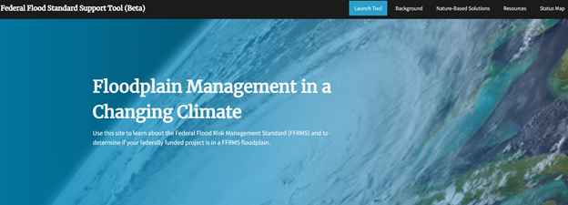
As part of this effort to protect communities from floods and build resilience in the face of the climate crisis, the White House today launched a draft (or beta) version of a new website and mapping tool that will help users to search an address to determine if that location is in a high flood risk area. The Federal Flood Standard Support Website and Tool will help users implement the Federal Flood Risk Management Standard (FFRMS). The FFRMS applies to projects where federal funds are used for new construction, substantial improvement, or repairs to address substantial damage. This can include projects such as critical infrastructure, affordable housing developments, renewable energy, or broadband internet projects. The Tool will help users seeking federal funding for such projects to determine if they will be located within an area with increased risk of flooding. As we seek to develop future versions of the tool, we are looking to gather input and feedback from the public to improve the tool’s functionality. The website and tool are aligned with the Biden-Harris Administration’s National Climate Resilience Framework’s objective to embed climate resilience into planning and management.

The launch of the beta version of the Federal Flood Standard Website and Tool comes as the Biden-Harris Administration continues to make historic investments to enhance community resilience and mitigate flood risk. In particular, the Administration is deploying:
- $3.5 billion in FEMA Flood Mitigation Assistance grants to improve community flood resilience.
- $17.1 billion for U.S. Army Corps of Engineers’ Civil Works Program for projects to reduce flood risk and protect people and property from floods.
- $2.6 billion in climate investments for the National Oceanic and Atmospheric Administration (NOAA) to improve coastal community resilience.
- $8.7 billion for the Department of Transportation’s PROTECT Program for climate and natural hazard resilient infrastructure and awarding $830 million today as part of those efforts.
- $220 million to the Bureau of Indian Affairs for Tribal climate adaptation and resilience.
- $300 million additional funding to bolster the Natural Resources Conservation Service’s Emergency Watershed Protection Program to assist communities with post flood recovery.
These landmark investments are part of the Biden-Harris Administration’s all-of-government effort to reduce flood risk. Across the country, Federal agencies are helping communities make major gains in resilience, including by deploying nature-based solutions and whole-system approaches that meet local needs. For example:
- FEMA is addressing flood risk in 25 Puerto Rico Municipalities and advancing innovative flood mitigation projects like Community Forms, which is an art installation in Denver, Colorado that serves as both a community gathering space and a means to redirect stormwater.

- Florida’s Tyndall U.S. Air Force Base has started a rebuilding program focused on creating a resilient, sustainable, and smart Installation of the Future that minimizes impacts of coastal flooding and erosion.
- The Department of Homeland Security Science and Technology’s Directorate is leading research on FloodAdapt, a community-oriented, modeling and impact assessment tool for compound flood events.
- NOAA launched a new website for water prediction and products, made major advancements in the capability to predict when and where high tide flooding may occur – up to a year in advance, and is supporting implementation of nature-based solutions to reduce coastal flood risk in Delaware.
- The U.S. Army Corps of Engineers is working with nature and communities to reduce flood risk across the country, including projects in Minnesota, New York, and Washington.
- The Environmental Protection Agency is increasing climate and flood resilience through its Water Finance and Innovation Act and Clean Water State Revolving Fund and the Campus RainWorks Challenge.
- The Department of Housing and Urban Development (HUD) is prioritizing smart, resilient construction that minimizes and protects communities from both current and future flood events by setting proactive elevation requirements for multi-family housing and by requiring all HUD’s Community Development Block Grant Disaster Recovery projects proposed in flood-prone areas be built to a higher flood standard.
Most importantly – you can play a major role in helping protect against the impacts of flooding! Floods can happen almost anywhere, even far from permanent bodies of water. Heavy rains, poor drainage, rapid snow melt, and even land use changes nearby, such as removal of wetlands and vegetation, can increase flood risk in your community. It is important that you have the information you need to prepare yourself and your family to stay safe before, during, and after flooding events. If you are under a flood warning, please make sure to follow evacuation orders, find shelter, and avoid walking, swimming, or driving through flood waters. You can learn more about how you can prepare and react in flooding situations:
- Floods | Ready.gov
- Flood Insurance | FEMA.gov
- Flood Safety | Flood Preparedness | American Red Cross
- Key Facts About Flood Readiness | CDC
- Flood Safety Tips and Resources (weather.gov)

